Learn more about Improving Road Safety
Read our one pager on how Altitude by Geotab can help improve road safety.
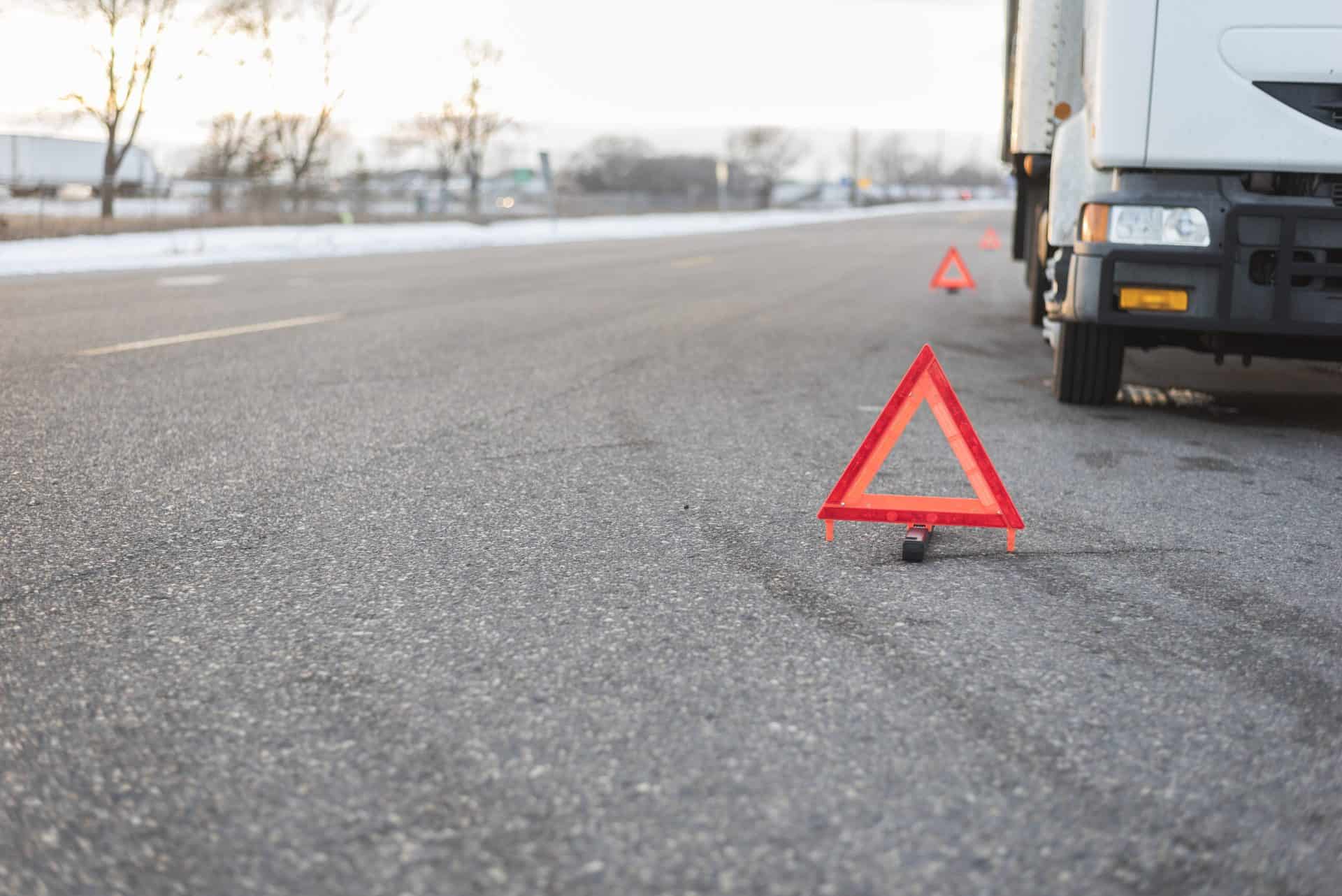
Implement preventative measures with insights into harsh driving risks before collisions occur.
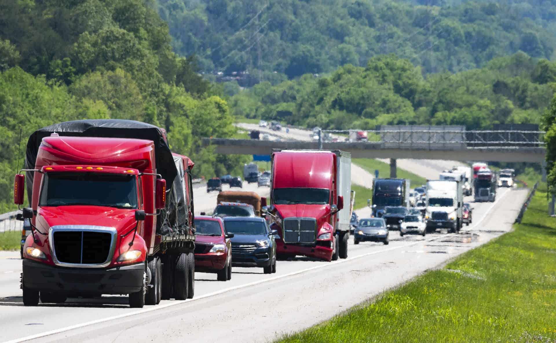
State and metropolitan transit planners and commercial companies face significant challenges related to understanding road safety. Keeping roads safe amidst growing traffic and urbanization requires comprehensive data and strategic planning. To address these challenges, the Altitude Platform provides detailed insights into traffic patterns and driving behaviors. Our platform helps you identify high-risk areas and develop targeted safety interventions, developing safer and more efficient road networks.
Drive toward safer streets by leveraging data on speeding and harsh events like braking, acceleration and cornering to inform targeted safety interventions and avoid accidents before they occur.
Lead efforts to eliminate road fatalities and injuries. Identify where risky driving behaviors occur, such as harsh braking, acceleration and cornering, allowing for targeted interventions to create safer streets for everyone.
Support planning with reliable traffic, speed and harsh event data with segmentable market-representative modeled AADT metrics to drive effective decision-making.
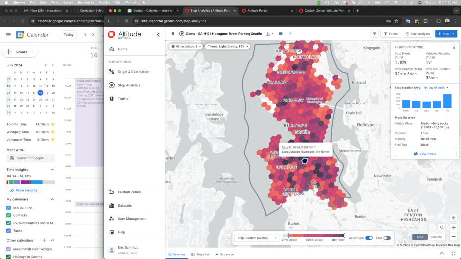
Surface the highest-risk road segments before collisions occur. Rank road segments by risk to enhance safety and measure proactivity. Highlight previously unknown risky roads that can’t be identified using only collision data.
Build a robust business case for traffic congestion and safety improvements. Quantify traffic throughput for any given interstate, bridge, road segment or intersection, justifying proposed methods to mitigate risks and improve traffic flow.
Support project decision-making by mapping out various areas to gain deeper insights and quantify the impact of planned interventions versus current conditions.
Analyze road segment performance, safety and travel times to support accessible planning initiatives and freedom of mobility for everyone. Identify travel times and flow to encourage equitable infrastructure development and investment across cities, states or regions.
Gain community and political support for safety initiatives. Visualize the impact of intervention measures and road projects, quantifying their effects on road risk, travel times and speed. Demonstrate the importance of safety measures to make roads safer for all.
Obtain detailed road segment risk, volume and flow data with tools built to improve your ability to implement safety measures and reduce travel times.


Altitude by Geotab provides reliable and contextualized mobility insights for public and commercial sector decision-makers to gain a complete understanding of movements across road networks.
This enables our customers to achieve improved planning capabilities as well as better financial outcomes, without the challenge of finding trustworthy and usable data sets.
As the primary source and processor of mobility data, we prioritize complete confidentiality and privacy while maintaining the full context of vehicle movements.
Experience strategic road safety planning with contextualized mobility insights. Book a demo to discover how you can achieve safer and more efficient road networks.